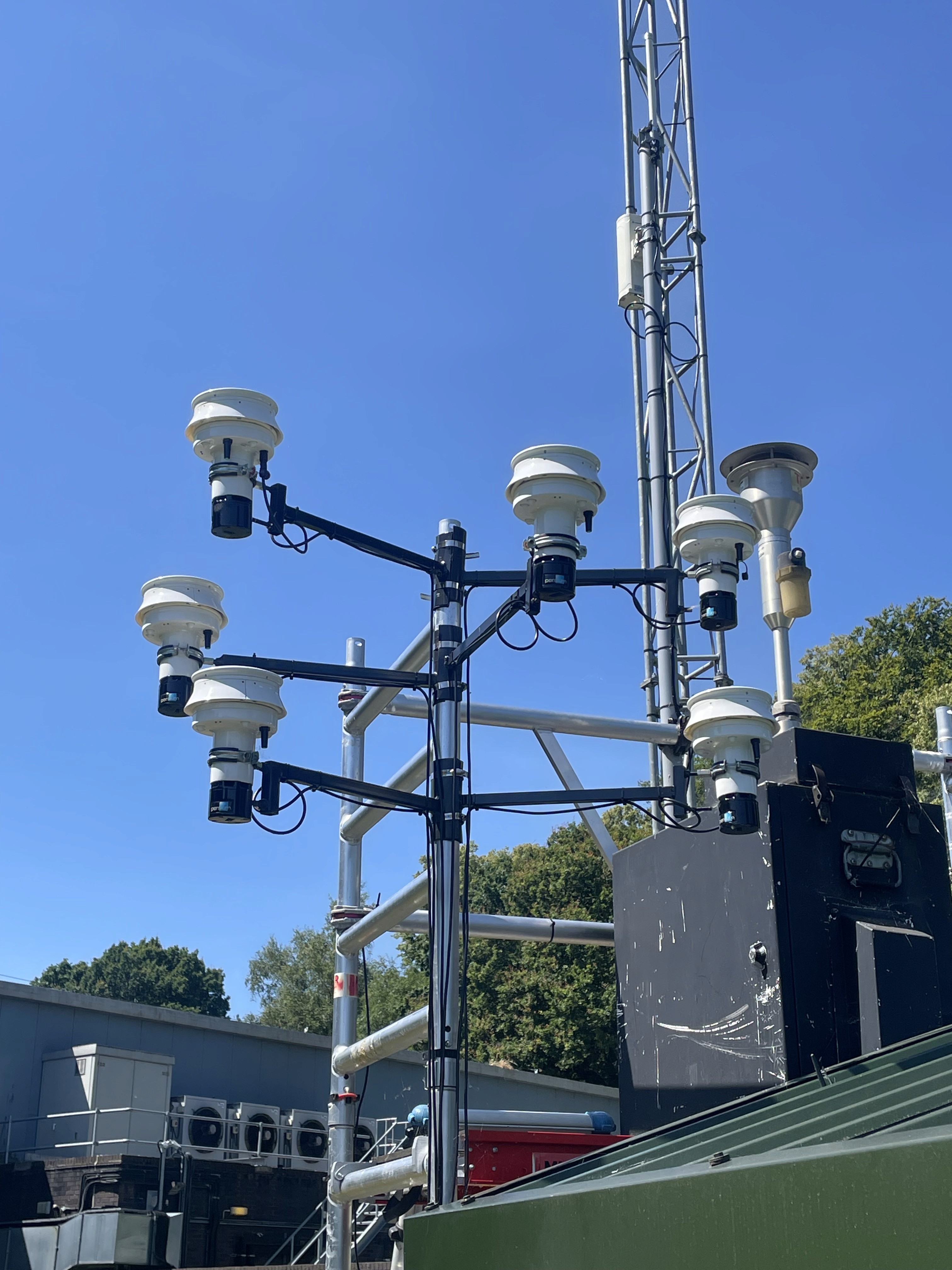
Designed for continuous outdoor deployment across real-world environments.
Dudley, UK 🇬🇧
Persium Case Study
Real-time air quality monitoring at residential scale in Dudley.
Dudley, UK 🇬🇧
Persium Case Study
Real-time air quality monitoring at residential scale in Dudley.
Project Summary
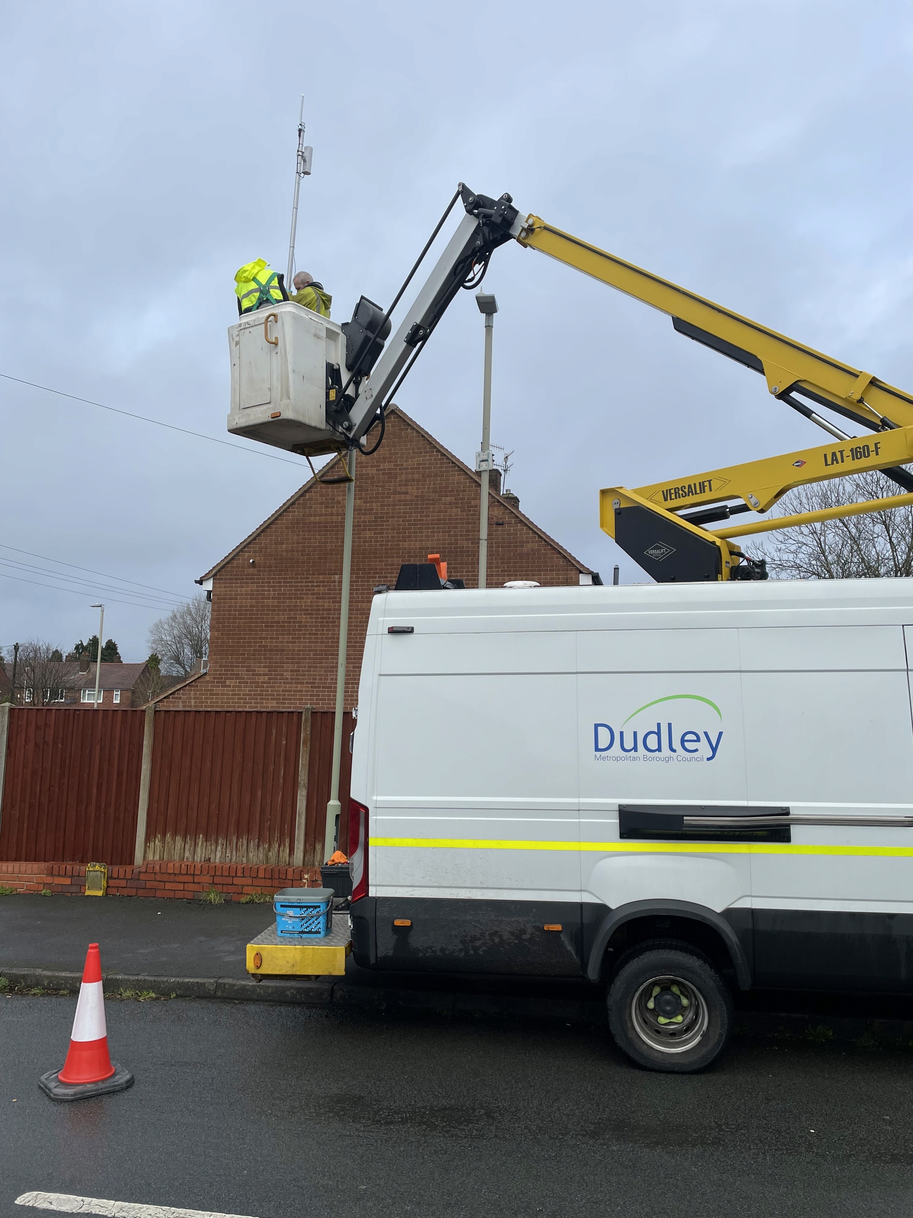
Persium deployed a real-time air quality monitoring network across residential areas in Dudley, focused on community-level exposure rather than area-wide averages.
Persium Pods are positioned at street level across neighbourhoods, providing continuous visibility into how air quality varies between local areas and helping identify potential pollution hotspots. All data streams into Persium MapView for live geospatial visibility, trend analysis and reporting.




The Challenge
Long-term exposure to air pollution does not only occur in commercial districts or on major roads. It happens in residential neighbourhoods, on local streets and near the homes where people spend most of their time.
Traditional monitoring often relies on a limited number of fixed stations that provide broad regional indicators, which can miss the local variation that shapes community exposure. Understanding pollution as people experience it requires monitoring at the scale of streets and neighbourhoods.
Persium Deployment
Persium deployed a real-time air quality monitoring network across residential areas in Dudley, focused on community-level exposure rather than area-wide averages.
Persium Pods are positioned at street level across neighbourhoods, providing continuous visibility into how air quality varies between local areas and helping identify potential pollution hotspots. All data streams into Persium MapView for live geospatial visibility, trend analysis and reporting.
Pollutants Measured
Air Quality: NO2, NO, O3, SO2, CO, CO2, CH4, PM1, PM2.5, PM10, NH3, H2S, CH3SH, VOC
Atmospheric: Thermal Work Limit, Max Noise, Solar Irradiance, Noise, WBGT, Temperature, Pressure, Humidity, Dew Point, Wind Chill, Heat Index, Wind, Wind Direction.
Persium Pod is fully configurable to match your monitoring needs, select from a comprehensive range of air quality and atmospheric parameters to suit your environment, industry, and regulatory requirements.
Monitoring through Dashboard & MapView
All data streams into Persium MapView — providing local authorities and stakeholders with live geospatial visibility of air quality conditions across the borough. Users can monitor pollutant trends in real time, compare data across locations, configure threshold alerts, and generate downloadable reports.
What This Enables
Neighbourhood-level monitoring gives local authorities and communities the evidence needed for targeted mitigation, identifying which streets and areas experience the highest exposure, informing smarter local policy, and demonstrating measurable progress over time. Environmental intelligence that reaches communities, not just city centres.
RECAP
Project Summary
Persium deployed a real-time air quality monitoring network across residential areas in Dudley, focused on community-level exposure rather than area-wide averages.
Persium Pods are positioned at street level across neighbourhoods, providing continuous visibility into how air quality varies between local areas and helping identify potential pollution hotspots. All data streams into Persium MapView for live geospatial visibility, trend analysis and reporting.
The Challenge
Long-term exposure to air pollution does not only occur in commercial districts or on major roads. It happens in residential neighbourhoods, on local streets and near the homes where people spend most of their time.
Traditional monitoring often relies on a limited number of fixed stations that provide broad regional indicators, which can miss the local variation that shapes community exposure. Understanding pollution as people experience it requires monitoring at the scale of streets and neighbourhoods.
Persium
Deployment
Persium deployed a real-time air quality monitoring network across residential areas in Dudley, focused on community-level exposure rather than area-wide averages.
Persium Pods are positioned at street level across neighbourhoods, providing continuous visibility into how air quality varies between local areas and helping identify potential pollution hotspots. All data streams into Persium MapView for live geospatial visibility, trend analysis and reporting.
Pollutants
Measured
Air Quality: NO2, NO, O3, SO2, CO, CO2, CH4, PM1, PM2.5, PM10, NH3, H2S, CH3SH, VOC
Atmospheric: Thermal Work Limit, Max Noise, Solar Irradiance, Noise, WBGT, Temperature, Pressure, Humidity, Dew Point, Wind Chill, Heat Index, Wind, Wind Direction.
Persium Pod is fully configurable to match your monitoring needs, select from a comprehensive range of air quality and atmospheric parameters to suit your environment, industry, and regulatory requirements.
Monitoring through Dashboard & MapView
All data streams into Persium MapView — providing local authorities and stakeholders with live geospatial visibility of air quality conditions across the borough. Users can monitor pollutant trends in real time, compare data across locations, configure threshold alerts, and generate downloadable reports.
What This Enables
Neighbourhood-level monitoring gives local authorities and communities the evidence needed for targeted mitigation, identifying which streets and areas experience the highest exposure, informing smarter local policy, and demonstrating measurable progress over time. Environmental intelligence that reaches communities, not just city centres.
Air quality monitoring should reflect how people actually experience pollution.
Talk to our team about deploying Persium across your local authority or community environment.
Air quality monitoring should reflect how people actually experience pollution.
Talk to our team about deploying Persium across your local authority or community environment.