
Use Case
Smart cities & local governments
Smart cities & local governments
Most cities make air quality decisions based on averages from a handful of fixed monitoring stations, leaving entire neighbourhoods, schools, and transport corridors effectively invisible. Without continuous, street-level data, it's impossible to know where exposure is highest, whether interventions are working, or how to demonstrate regulatory compliance with confidence.
THE CHALLENGE
Cities are responsible for the air millions of people breathe. Most still can't measure it properly.
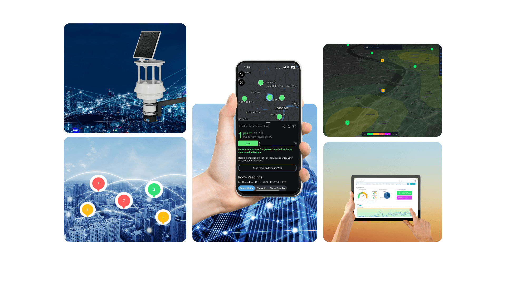
Persium deploys networks of IoT air quality sensors across key urban locations, streets, parks, schools, transport corridors, and residential zones. Each sensor continuously monitors up to 12 pollutants alongside wind, noise, temperature, and atmospheric conditions. All data feeds into Persium's Dashboard and MapView platform, delivering live heatmaps, 3D digital twin visualisations, AI-driven forecasting, and exportable compliance reports across your entire network from one connected platform.
Dense sensor networks. Real-time intelligence. City-scale visibility.
WHAT PERSIUM DOES
Most cities make air quality decisions based on averages from a handful of fixed monitoring stations, leaving entire neighbourhoods, schools, and transport corridors effectively invisible. Without continuous, street-level data, it's impossible to know where exposure is highest, whether interventions are working, or how to demonstrate regulatory compliance with confidence.
THE CHALLENGE
Cities are responsible for the air millions of people breathe. Most still can't measure it properly.
Persium deploys networks of IoT air quality sensors across key urban locations, streets, parks, schools, transport corridors, and residential zones. Each sensor continuously monitors up to 12 pollutants alongside wind, noise, temperature, and atmospheric conditions. All data feeds into Persium's Dashboard and MapView platform, delivering live heatmaps, 3D digital twin visualisations, AI-driven forecasting, and exportable compliance reports across your entire network from one connected platform.
WHAT PERSIUM DOES
Dense sensor networks. Real-time intelligence. City-scale visibility.
Hyperlocal mapping replaces guesswork
Dense sensor networks reveal where pollution concentrates at street level, not just borough averages. City planners can see which junctions, school streets, and residential corridors carry the highest exposure, and design interventions that target the right locations.
CITY PLANNING & MOBILITY
How air quality data changes urban planning decisions.
Digital twinning lets you test before you build
Persium's 3D digital twin platform allows planners to model how proposed changes, new roads, green corridors, traffic restrictions, or bus route changes, will affect pollution levels across an area before any physical change is made. Evidence before commitment.
Connecting mobility and air quality
Wind-correlated data links pollutant spikes to specific vehicle types, road segments, and times of day,giving transport and planning teams the precision they need to prioritise the right interventions in the right places.
Clean Air Zone planning and evaluation
Persium data supports the full CAZ lifecycle, from baseline monitoring before implementation, to real-time tracking during operation, to before-and-after analysis that demonstrates whether the zone is delivering measurable improvement. Data that holds up in a scrutiny committee.
Hyperlocal mapping replaces guesswork
Dense sensor networks reveal where pollution concentrates at street level, not just borough averages. City planners can see which junctions, school streets, and residential corridors carry the highest exposure, and design interventions that target the right locations.
CITY PLANNING & MOBILITY
How air quality data changes urban planning decisions.
Digital twinning lets you test before you build
Persium's 3D digital twin platform allows planners to model how proposed changes, new roads, green corridors, traffic restrictions, or bus route changes, will affect pollution levels across an area before any physical change is made. Evidence before commitment.
Clean Air Zone planning and evaluation
Persium data supports the full CAZ lifecycle, from baseline monitoring before implementation, to real-time tracking during operation, to before-and-after analysis that demonstrates whether the zone is delivering measurable improvement. Data that holds up in a scrutiny committee.
Connecting mobility and air quality
Wind-correlated data links pollutant spikes to specific vehicle types, road segments, and times of day,giving transport and planning teams the precision they need to prioritise the right interventions in the right places.
DEPLOYMENTS
Deployed in UK Cities
Westminster, Southwark and Dudley are already using Persium.
Persium is deployed across Westminster and Southwark, integrating air quality data with the Westminster Health Index to connect pollution exposure with hospital admissions, school performance, and socio-economic outcomes. In Dudley, a residential monitoring network delivers hyperlocal visibility into community-level exposure at street scale.
Westminster, Southwark and Dudley are already using Persium.
Persium is deployed across Westminster and Southwark, integrating air quality data with the Westminster Health Index to connect pollution exposure with hospital admissions, school performance, and socio-economic outcomes. In Dudley, a residential monitoring network delivers hyperlocal visibility into community-level exposure at street scale.
DEPLOYMENTS
Deployed in UK Cities
Westminster, Southwark and Dudley are already using Persium.
Persium is deployed across Westminster and Southwark, integrating air quality data with the Westminster Health Index to connect pollution exposure with hospital admissions, school performance, and socio-economic outcomes. In Dudley, a residential monitoring network delivers hyperlocal visibility into community-level exposure at street scale.


Built for every industry where air quality matters.
Built for every industry where air quality matters.